
Satellite tracks from young whale sharks off northeastern Australia help predict where the sharks may find food, and how that changes through the year. The models suggest suitable habitat is concentrated on the northern Great Barrier Reef in the monsoon season. In the dry season, it shifts northeast into the Coral Sea and toward Papua New Guinea.
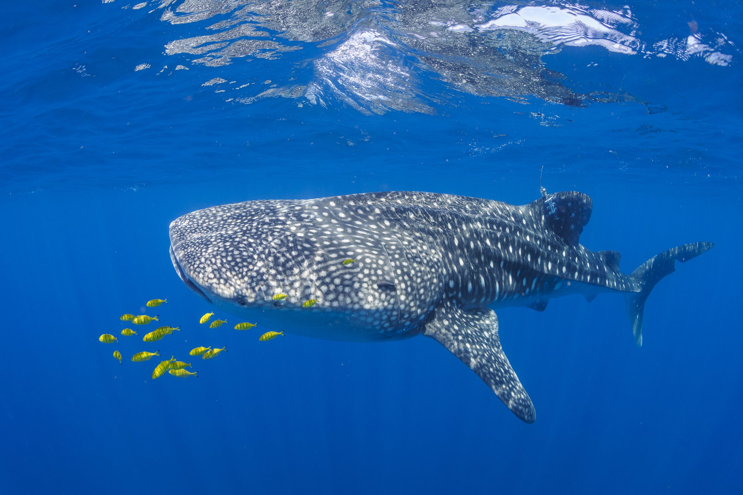
A satellite-tagged whale shark at Wreck Bay on the far northern Great Barrier Reef, where most of the study’s tags were deployed.
Following the sharks
Whale sharks (Rhincodon typus) are Endangered, and the southwest Pacific has been one of the biggest gaps in what we know about where they go. Only about 30 places worldwide are known where whale sharks gather, and until recently none had been documented in the southwest Pacific east of Australia. The discovery of a gathering at Wreck Bay, on the far northern Great Barrier Reef, gave researchers a place to start.
The new study in Diversity and Distributions was led by Dr. Ingo Miller of Biopixel Oceans Foundation and James Cook University. MMF Co-Founder and Executive Director Dr. Simon Pierce is a co-author and contributed to the research.
Between 2018 and 2024, the team attached 39 satellite tags, 36 of them at Wreck Bay. They then picked out the parts of each track where a shark slowed down and stayed in one area, a sign that it was likely feeding or resting. The final analysis used 30 tracks from young whale sharks. The team compared three different computer models and combined their predictions, showing where the models agreed and where uncertainty remained.
A seasonal picture
During the monsoon season, from November to April, the models predicted the most suitable habitat on the northern Great Barrier Reef. During the dry season, from May to October, it shifted northeast into the Coral Sea, along the coast of Papua New Guinea, and toward the Solomon Sea and Vanuatu.
Depth and steep underwater slopes were among the features most strongly linked to suitable habitat, along with sea surface temperature and chlorophyll levels. Chlorophyll comes from microscopic algae and is a sign of productive water. The sharks are probably not drawn to the slopes themselves: these features can bring nutrient-rich water to the surface, feeding the zooplankton (tiny drifting animals) that whale sharks eat.
These maps show where conditions are predicted to suit young whale sharks, not a count of sharks or proof of feeding at every location. Independent sightings broadly supported the pattern, although the models were only moderately accurate. All of the tracked sharks were young and most were male, so the results apply mainly to young males and may not reflect where adults or females feed.
What comes next
The maps can help researchers decide where and when to look for other whale shark gathering sites. The authors suggest prioritizing surveys along a chain of islands and nearby slope waters toward Vanuatu, the Solomon Islands, and Papua New Guinea. Early data from the study have already been used in global assessments of the risk from shipping, which found a major shipping route overlapping suitable habitat off the north Queensland coast. The authors also call for tracking more female and adult whale sharks in the region.
Funding came from the Queensland Government’s Threatened Species Research grant, the Sapphire Project, Blancpain Ocean Commitment, Georgia Aquarium, Sea World Foundation, Conservation International, MAC3 Impact Philanthropies, the Slattery Family Trust, and 4planet. Read the full paper, visit our whale shark page, or adopt a whale shark to support new research on whale sharks.