A marine park can protect a large area and still miss the places its rays use most. In eastern Moreton Bay, Australia, a new study finds that only about 11% of the area surveyed lies within zones closed to fishing. The busiest ray habitat at the site with the most rays lies outside them.
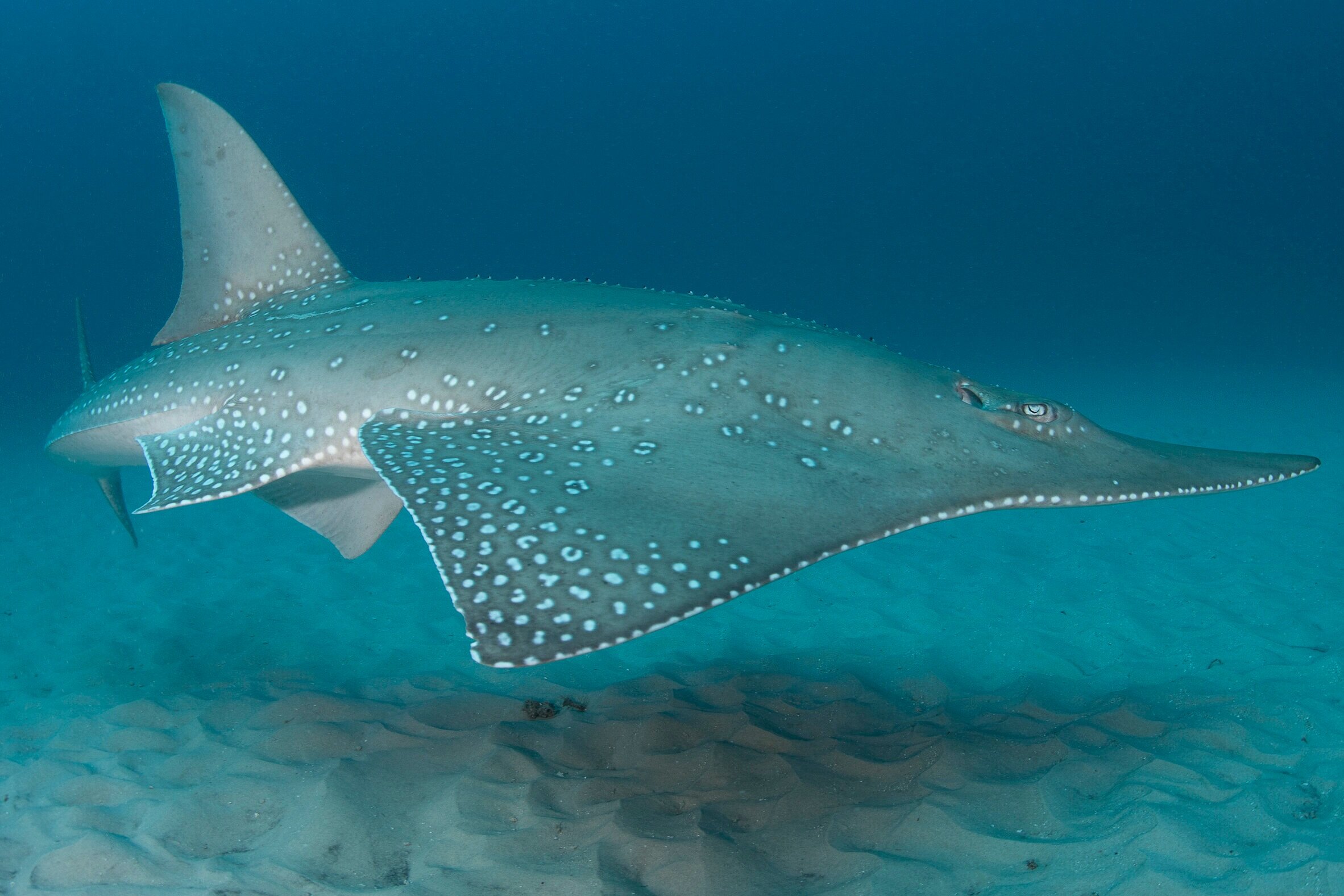
A wedgefish over sand in Mozambique’s Bazaruto Archipelago. Wedgefishes and shovelnose rays, known together as rhino rays, include the two Critically Endangered species recorded in this study.
Counting rays in the shallows
Ciaran Hyde of the University of the Sunshine Coast led the new study, published in Aquatic Conservation: Marine and Freshwater Ecosystems. His co-authors came from Charles Darwin University, Griffith University, and MMF, including MMF Co-Founder and Executive Director Dr. Simon Pierce.
From October 2017 to March 2020, the team surveyed 12 sites in eastern Moreton Bay, Queensland, during the warmer months from October to April. They covered four habitat types: mangrove edges, sand flats, seagrass meadows, and reefs close to shore. In the clear shallows, observers counted rays from a slow-moving boat; in slightly deeper water, they used baited underwater cameras. Over 169 survey hours, they made 1,195 observations of rays from 13 species.
Where the rays are
The team recorded the most rays, and the most kinds of ray, in the central eastern bay, where mangrove edges and sand flats sit side by side. Crab Island alone accounted for 653 of the observations, followed by Wanga Wallen Banks with 302 and Moreton Banks with 130. The team watched rays move about 500 meters (1,600 feet) out from the mangroves onto the sand flats to feed, then return.
Adults and young of three species were seen at these central sites, suggesting these areas may also be important for breeding. They were the giant shovelnose ray (Glaucostegus typus), the white-spotted eagle ray (Aetobatus ocellatus), and the estuary stingray (Hemitrygon fluviorum). The surveys also recorded two species listed globally as Critically Endangered, the giant shovelnose ray and the bottlenose wedgefish (Rhynchobatus australiae), in habitats that currently lack strong protection.
A gap in protection
Moreton Bay Marine Park includes no-take zones, where fishing is prohibited. Yet only 6.83 square kilometers (2.64 square miles), or about 11% of the 62.1 square kilometers (24.0 square miles) the team surveyed, fell inside them. Crab Island had the most rays. Its nearby no-take zone covers only the area inside the mangrove line, so the busy ray habitat on the island’s western side lies outside it.
The authors recommend reviewing the boundaries of several no-take zones so they include more of the mangrove and sand-flat habitat rays depend on. Nine of the 12 sites showed potential to qualify as Important Shark and Ray Areas, an international system for flagging critical shark and ray habitat. Tracking studies would add to the picture by showing how individual rays use these connected habitats over time. Findings like these help managers decide which ray habitats to prioritize when they review protected-area boundaries.
The authors acknowledge the Jinibara, Kabi Kabi, and Turrbal peoples as the traditional custodians of Quandamooka (Moreton Bay). This work was supported by an Australian Government Research Training Program Scholarship and by Griffith University, with accommodation and vessels donated by Tangalooma Island Resort. Read the open-access paper, or make a donation to support new research on sharks and rays.